Customize Consent Preferences

We use cookies to help you navigate efficiently and perform certain functions. You will find detailed information about all cookies under each consent category below.

The cookies that are categorized as "Necessary" are stored on your browser as they are essential for enabling the basic functionalities of the site. ... 

Always Active

Necessary cookies are required to enable the basic features of this site, such as providing secure log-in or adjusting your consent preferences. These cookies do not store any personally identifiable data.

No cookies to display.

Functional cookies help perform certain functionalities like sharing the content of the website on social media platforms, collecting feedback, and other third-party features.

No cookies to display.

Analytical cookies are used to understand how visitors interact with the website. These cookies help provide information on metrics such as the number of visitors, bounce rate, traffic source, etc.

No cookies to display.

Performance cookies are used to understand and analyze the key performance indexes of the website which helps in delivering a better user experience for the visitors.

No cookies to display.

Advertisement cookies are used to provide visitors with customized advertisements based on the pages you visited previously and to analyze the effectiveness of the ad campaigns.

No cookies to display.

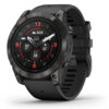
Garmin GPSMAP® 65S Multi-Band/GNSS Handheld Tracking

449,00 

Explore more with this rugged handheld that offers optimal tracking accuracy, a 2.6-inch colour display and preloaded maps.

Delivery information:

Code EAN: 0753759257873 SKU: 13327 Categories: , Tags: , , Brand:

FIND YOUR WAY IN THIS BIG, WIDE WORLD

Explore more with this rugged handheld that offers optimal tracking accuracy, a 2.6-inch colour display and preloaded maps.

Don’t miss a detail with this large, sunlight-readable colour display.

Lead the way in challenging locations with multi-band technology and expanded GNSS satellite support.

Cross the countryside with routable TopoActive Europe maps.

Plot your next move with built-in navigation sensors.

Organize your adventure from anywhere with the Garmin Explore website and app.

Travel with up to 16 hours of battery life in GPS mode.

Follow your path.

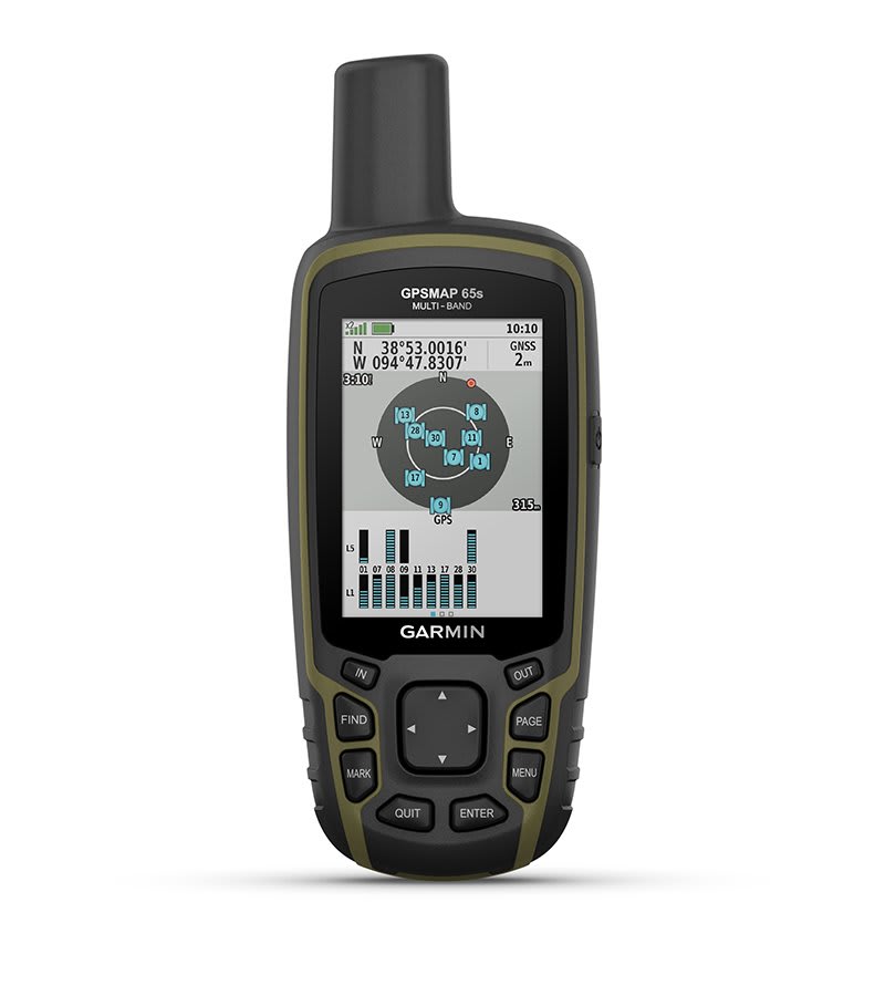
EXPANDED GNSS SUPPORT

Multi-band technology and expanded GNSS support (GPS, GLONASS, Galileo, QZSS and IRNSS) provide optimal accuracy in steep country, urban canyons and forests with dense trees.
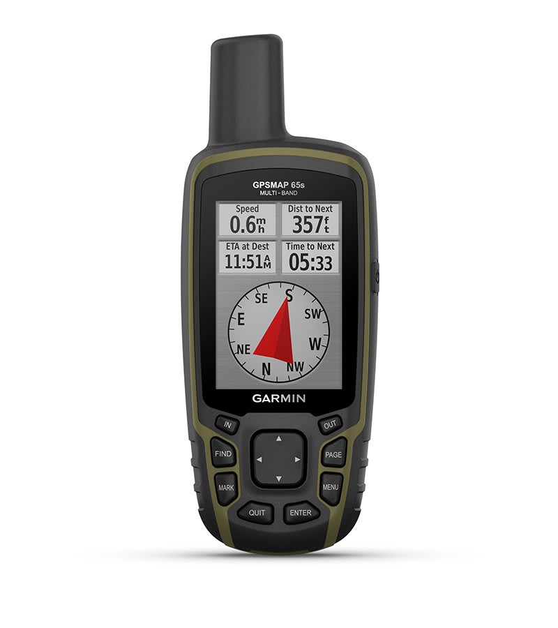
ABC SENSORS

Navigate every trail with ABC sensors, including an altimeter for elevation data, barometer to monitor weather and 3-axis electronic compass.

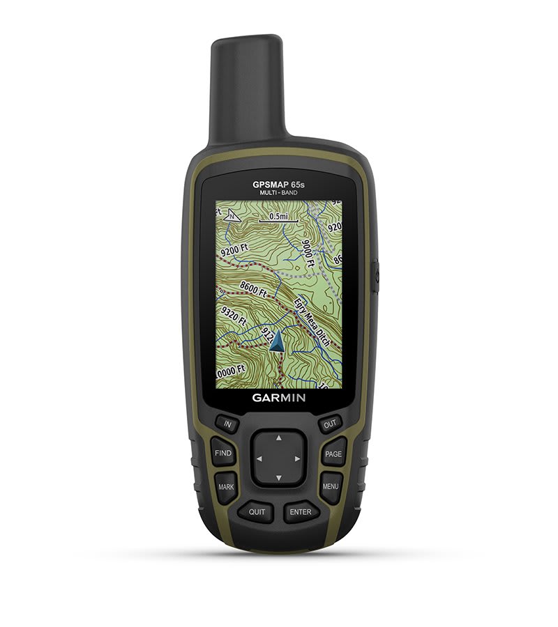
PRELOADED TO PROACTIVE EUROPE MAPS

Preloaded TopoActive Europe maps provide detailed views of routable street and off-road networks, waterways, natural features, land use areas, buildings, and more.
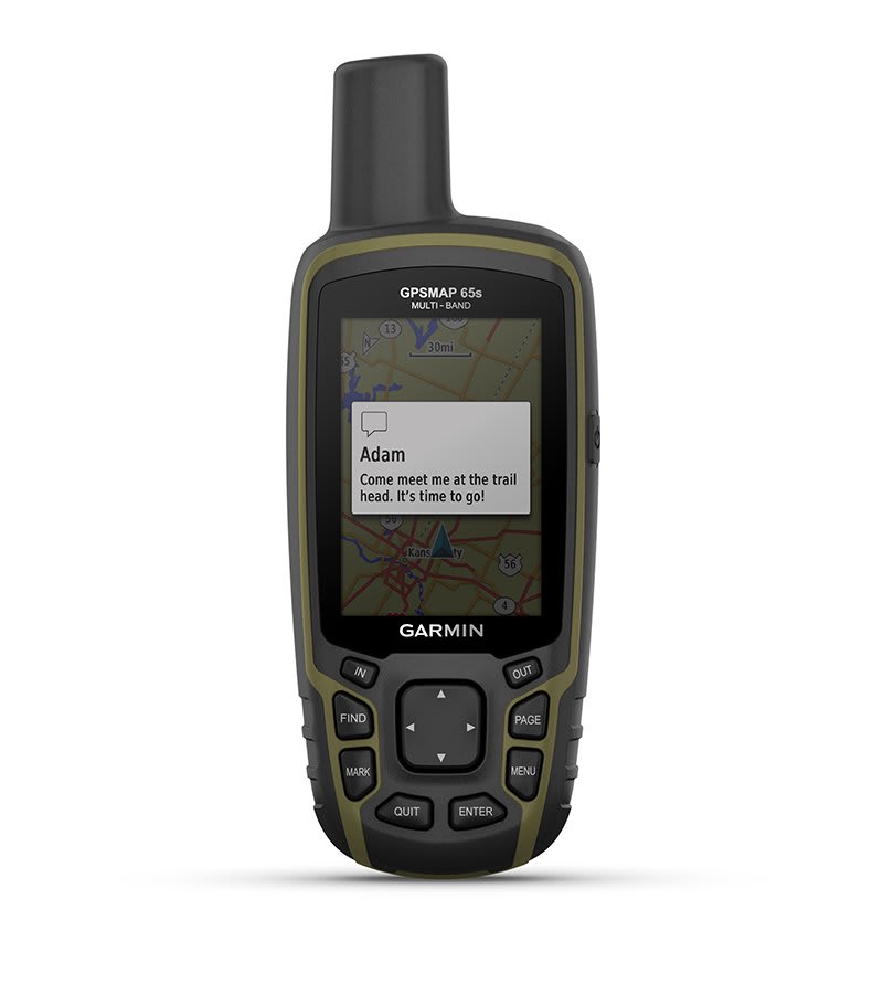
SMART NOTIFICATIONS

Receive emails, texts, and alerts right on your handheld when paired with your compatible device.
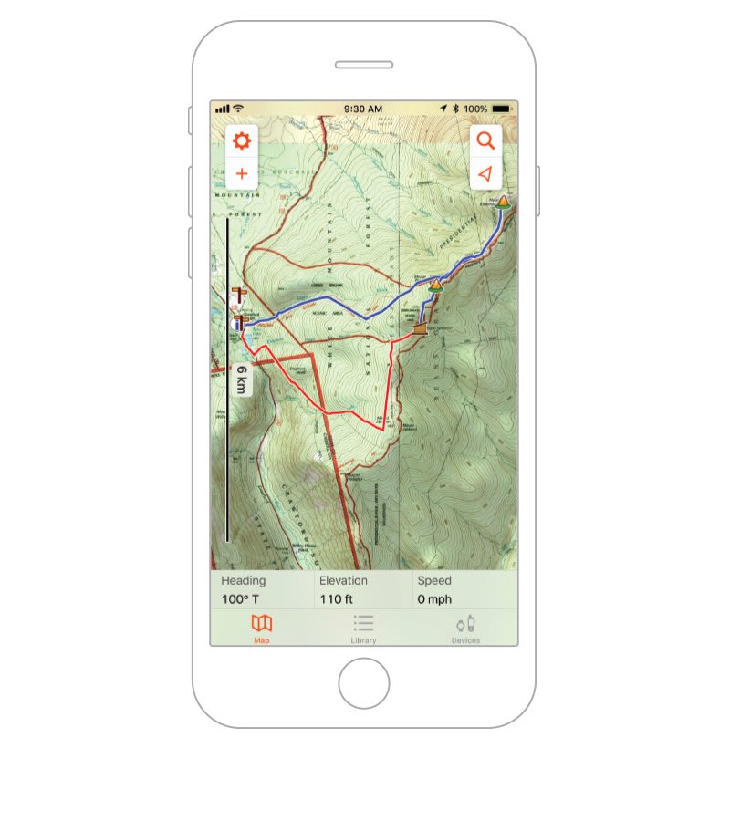
GARMIN EXPLORE APP

Plan, review, and sync waypoints, routes, and tracks by using the Garmin Explore app and website. You can even review completed activities while still in the field.

GEOCACHING

Get automatic cache updates from Geocaching Live, including descriptions, logs and hints.

MICROSD SLOT

Using your compatible device and microSD memory card, conveniently download TOPO 24K maps and hit the trail.


Garmin Explore app for off-grid navigation and more.

Specifications

General

LENS MATERIAL

chemically strengthened glass

DIMENSION6.1 x 16.0 x 3.6 cm
WEIGHT217 g with batteries
WATERPROOFIPX7
DISPLAY TYPETransflective, 65K color TFT
DISPLAY SIZE3.6 x 5.5 cm; 2.6-inch diagonal (6.6 cm)
DISPLAY RESOLUTION160 x 240 pixels
BATTERY TYPE2 AA batteries (not included); NiMH or Lithium recommended
BATTERY LIFE16 hours
MEMORY/HISTORY16 GB (user space varies based on included mapping)
INTERFACEHigh-speed mini USB and NMEA 0183 compatible

Maps & Memory

PRELOADED MAPSYes (TopoActive Europe; routable)
ABILITY TO ADD MAPSYes
BASEMAPYes
AUTOMATIC ROUTING (TURN BY TURN ROUTING ON ROADS) FOR OUTDOOR ACTIVITIESYes
MAP SEGMENTS3,000
SATELLITE IMAGERY250 BirdsEye Imagery files
INCLUDES DETAILED HYDROGRAPHIC FEATURES (COASTLINES, LAKE/RIVER SHORELINES, WETLANDS AND PERENNIAL AND SEASONAL STREAMS)Yes
INCLUDES SEARCHABLE POINTS OF INTERESTS (PARKS, CAMPGROUNDS, SCENIC LOOKOUTS AND PICNIC SITES)Yes
DISPLAYS NATIONAL, STATE AND LOCAL PARKS, FORESTS, AND WILDERNESS AREASYes
STORAGE AND POWER CAPACITYYes (32 GB max microSD card)
WAYPOINTS/FAVOURITES/LOCATIONS5,000
TRACKS200
NAVIGATION TRACK LOG10,000 points, 200 saved tracks
NAVIGATION ROUTES200, 250 points per route; 50 points auto routing

Sensors

GPSYes
GLONASSYes
GALILEOYes
QZSSYes
BAROMETRIC ALTIMETERYes
COMPASSYes (tilt-compensated 3-axis)
HIGH-SENSITIVITY RECEIVERYes
GPS COMPASS (WHILE MOVING)Yes
MULTI-BAND FREQUENCYYes

Daily smart features

SMART NOTIFICATIONS ON HANDHELDYes
VIRB® CAMERA REMOTEYes
COMPATIBLE WITH GARMIN CONNECT MOBILEYes

Outdoor recreation

POINT-TO-POINT NAVIGATIONYes
AREA CALCULATIONYes
FISH FORECASTYes
SUN AND MOON INFORMATIONYes
GEOCACHING-FRIENDLYYes (paperless)
CUSTOM MAPS COMPATIBLEYes (500 custom map tiles)
PICTURE VIEWERYes

Outdoor applications

COMPATIBLE WITH GARMIN EXPLORE APPYes
GARMIN EXPLORE WEBSITE COMPATIBLEYes

Connections

CONNECTIONS WIRELESS CONNECTIVITYYes – Bluetooth®, ANT+®

Security Information

SECURITY UPDATES UNTIL AT LEAST (YYYY-MM-DD)2022-09-24

In the Box

  • GPSMAP 65s
  • USB cable
  • Carabiner clip
  • Documentation